Sunday, 9 October, Koblenz, Germany (Ehrenbreitstein Fortress at last)
Written 14 March 2023 (Happy pi day!)
 We passed through Frankfurt in the night, and at breakfast time, we were waiting in the queue for the lock at the last bridge before the Main joins the Rhine, in Hochheim. The lock is normally two lanes, but one lane is down for repairs, and the bottleneck of putting all boats through the single remaining lane is causing a back-up. A flock of starlings were perched on the light poles overhead.
The program for the day was to get through this lock, make a right turn onto the Rhine a short while later, then to cruise the famous "castles of the Rhine" to Koblenz, arriving there in midafternoon.
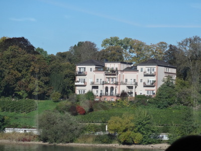
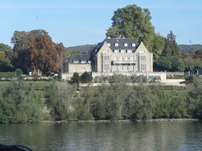
 Before we reached the officially scenic area, though, we cruised by many handsome buildings along the river, like these two. I'm afraid I don't know what they are—they're probably hotels, at least now, but they may have been private houses once.
They're not regarded as historic enough to be included in the narration.
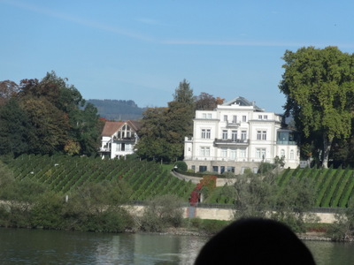
 The one at the left here looks particularly as though it might be (or have been) a private home.
The one on the right is definitely castle-like, but I don't have any idea of its real age.
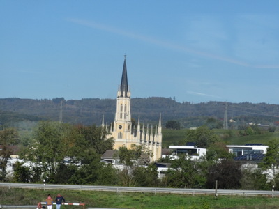
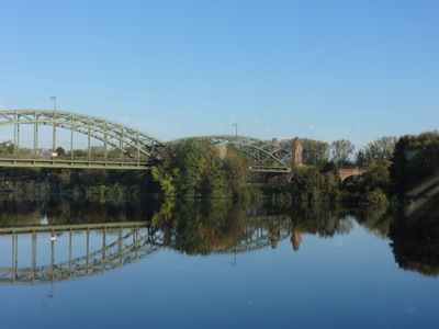
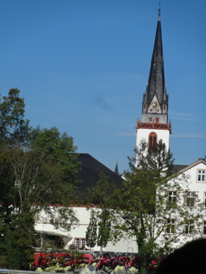 Handsome churches were also thick on the ground.
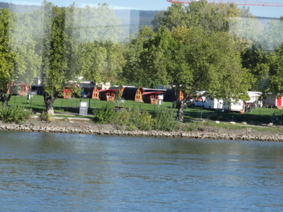
 We passed this cute little motel/campground in which the individual cabins were all in the shape of big barrels.
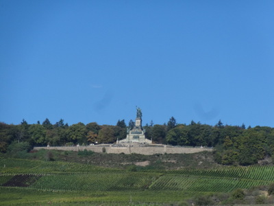
Near Rüdesheim, we passed the Niederwald Monument, built in 1871 at a cost of about a million gold marks to commemorate the unification of Germany (after the end of the Franco-Prussian war), who/which is represented as a woman, holding her recovered crown.
Then the official castles started. We covered this same stretch, but in the opposite direction—Koblenz in the morning, castles in the afternoon—in 2019, cruising with Viking from Paris to the Swiss alps. On that trip, I found very frustrating my attempt to match my photos to the names of the castles as, announced by our program director. More than one ruin were in sight at once, and I wasn't always sure which one was being pointed out, and I had no way to index my recorded notes to the photos I took.
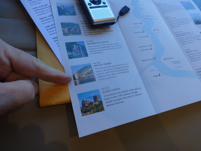 This time, Viking introduced an innovation that made things much easier—a trifold brochure in which pictures of all the major castles appeared alongside their names, mileage on the Rhine, and brief write-up. After I photographed a ruin, I was able to photograph my copy of the brochure, with my finger indicating the entry for the castle in the preceding photo, like this!
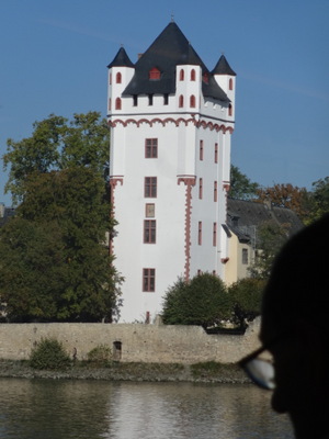
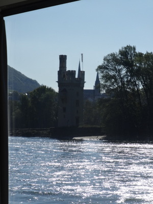
This is Mouse Tower (not to be confused with Maus Castle), a former toll tower. It got its name from the legend that mice ate a bishop who was imprisoned there.
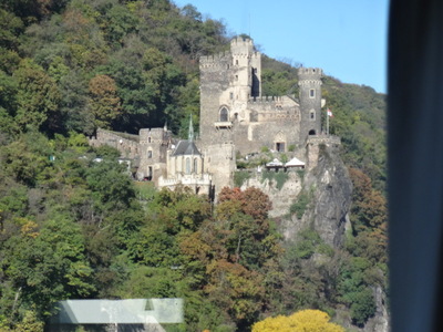
 These two are Rheinstein (left) and Reichenstein (right). According to legend, Gerda of Rheinstein wanted to marry Helmbrecht of Sternberg. Helmbrecht asked his uncle Gunzelin or Reichenstein (next door neighbor of Rheinstein) to speak for him, but Gunzelin proposed to her himself, and Gerda's father accepted.
On the wedding day, though, a sympathetic water nymph caused hornets to attack the couple on the way to the church, causing Gunzelin to fall to his death from the cliff. Helmbrecht rescued Gerda, and they were married a week later.
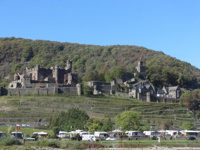
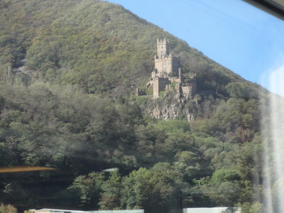
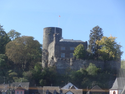
Some of these castles are now ruins, but others are now, e.g., hotels and restaurants.
 At the left here is Sooneck, built in 1834 by the crown prince of Prussia.
At the right is Heimberg, originally from the 13th century, but destroyed by Louis IV and rebuilt in the 19th century
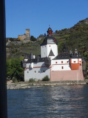
 At the left here are Pfalzgrafenstein ("the Pfalz," down on the shore) and Gutenfels (up on the hill) castles. The Pfalz was a toll station, with the guns up in Gutenfels to back up its authority. I'm not sure about the Pfalz, though it's clearly well kept, but Gutenfels has "HOTEL" painted across the front of its wall.
Just along here, about river kilometer 545–546, the Rhine is at its shallowest. This summer, it was down to 30 cm.
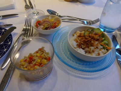
At the right are the fine-print lunch-time appetizers: tuna, quinoa with corn, and rice with sweet and sour veggies, I think.
The soup and main course, not shown, were leek and potato soup and open-faced smoked salmon sandwich, I think.
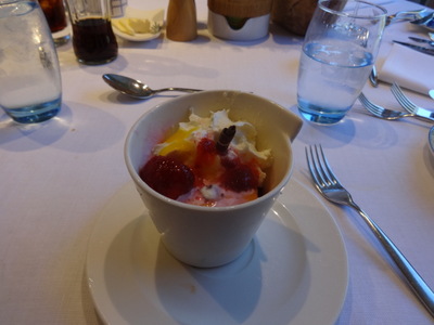
 The dessert was strawberries Romanoff, supposedly; I'm not sure what the mango sauce was doing in there.
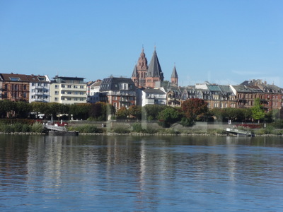
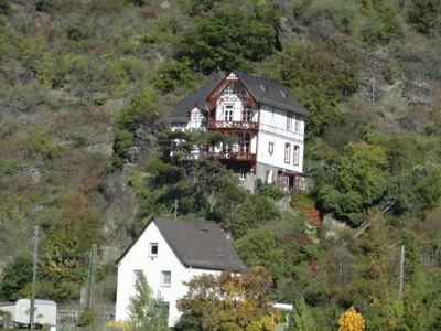
During lunch, we passed this handsome building, not an official castle of the Rhine.
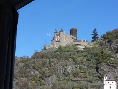
 These two are Katz (left) and Maus (right) castles. Katz has been tehre since the 14th century. It was heavily damage by Napoleon's people in 1806 but rebuilt in Victorian times. Maus was dubbed "Mouse" by the residents of the larger Katz. It's been restored and has "abundant medieval charm."
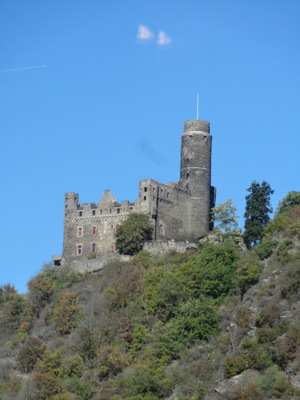
 These are Liebenstein (left) and Sterrenberg (right) castles, dating from the 13th and 12th centuries, respectively. Liebenstein is the highest on the Rhine, and its tower now contains a hotel and restaurant.
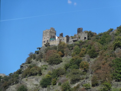
The castles I show here are just a sampling—the ones I happened to get reasonably good photos of. The brochure lists many, many more.
As we approached Koblenz, we moored briefly at Braubach to let the folks off who had signed up for the tour of Marksburg Castle, then continued on, arriving in Koblenz about 3 pm.
We were in Koblenz in 2019, cruising with Viking from Paris to the swiss Alps, so we had already done the walking tour of the city and the Moselle wine tasting (Koblenz is at the confluence of the Rhine and the Moselle). If you want to read more about the city and more history about the castles of the Rhine, visit my travel diary for (a href="https://www.bio.fsu.edu/~thistle/blog19/19-06-27.html">27 June 2019. The wine tasting was the previous day.
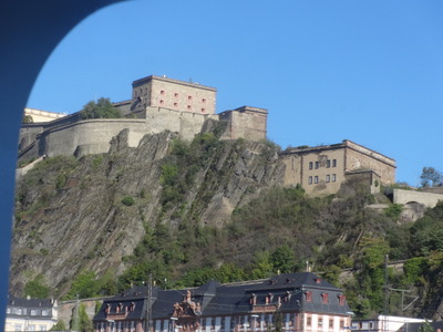
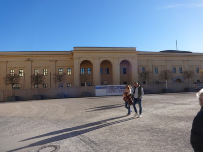
 On that occasion, I took the cablecar up to the Ehrenbreitstein Fortress (shown here at the left) but didn't have time to do anything but walk around a little then ride back down again (I really just wanted to ride the cablecar). So this time, I signed us up for the tour of the fortress, which David seconded, as he loves touring fortresses, even though he didn't look forward to the cablecar.
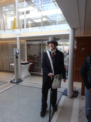
At the right here is our tour guide, waiting for us in the lobby of the ship. At the time, we all just assumed he had rather flamboyant taste in clothes—cravat, wing collar, frock coat, the hat, and the silvertopped cane—we even complimented him on it. But it turned out that, as part of the theme of the tour, he was impersonating a 19th-century British spy who famously infiltrated the fortress, mapped it and all its defenses, and published them later. All the other guides were dressed the same way.
 The first step was to walk the few yards from our mooring to the base of the cablecar line, where our guide handed out tickets. We all piled aboard (each car held about 20 people) and started upward. David even kept his eyes open.
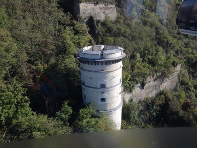
At the left here is our ship (the one on the right, moored outboard of the Viking Sigrun, as we started up. Closer to the top was this white tower, one of the outlying fortifications of the fortress.
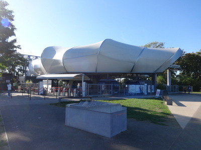
 This modernistic structure (left) is the upper terminus of the cablecar, viewed from outside after we disembarked. The one at the lower end looks very much the same.
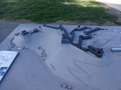
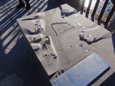
At the right is the obligatory relief model, labeled in braille for the blind but very useful to the sighted as well.
The site is an obvious one for fortification. It's 350 ft above the Rhine, and two sides fall away sheer to the rhine so only the third side is available for attach. The Celts fortified it, then the Romans did. An 11th century castle was built there and was upgraded gradually until well into the 18th century. The French blew it up with 2000 lb of gunpowder, but it ws rebuilt in 1814, bigger, better, and the most modern of its kind. I think that's when, according to the guide, Cologne ws the most important of a line of fortifications of which this was one.
About 6500 people worked for 20 years to finish it. It housed 1000 troops in peacetime, 1500 in wartime. The sections of the fortress are separated by ditches and joined by bridges.
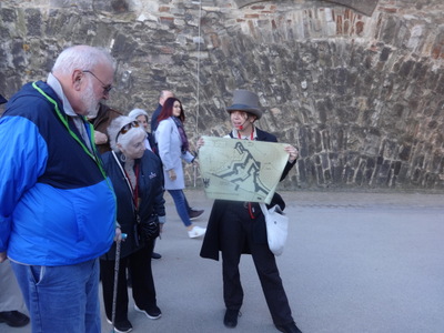
 Aside from the basic structure of the fortress—the layout, walls, some empty rooms, etc.—the guide didn't really have much to show us. Here he is holding up a map as he explains why the interior walls are placed as they are. Their angles (and even the angles of the loopholes for riflemen) were carefully chosen to ensure that intruders had no place to hide—every inch was in some defender's line of fire.
He also pointed out the "fountain" arrangement of the stones in the wall behind him. Most of the walls were constructed that way, rather than in straight courses of stone or brick, because the fountains imparted many of the characteristics of the arch to the wall, adding to their strength and stability. The outer walls are 12 feet thick. (The Prussians apparently fired cannons at their own walls to test their strength.)
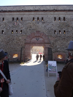
At the right is a gate leading into a broad open courtyard. All those arches embedded in the wall are not openings that were bricked up later, as you might guess, but were embedded in the wall from the start, to lend strength. Note also all the loopholes, each one angled slightly differently to ensure complete coverage. Every "layer" of the complex was fortified, so that even if enemies breached the outer walls, the inner ones could be further defended. Both counterguards and the ravelin would have to be taken before you'd have a chance of conquering the rest of the fortress (these structures were conveniently labeled to help us visualize the situation).
The fortress was never taken, but mainly because it was never attacked. The British spy's published description (which was translated into several languages, including French) convinced everybody that it was easier just to go around it. Then shortly afterward the border moved, and the place was no longer on a border to be guarded.
In our opinion, the tour was not enhanced by the elaborate conceit of the British spy. The guide kept designating members of our group as one character or another and variously imprisoning them, killing them off, or confiding in them. He had, however, very successfully learned the role from the training tapes he was given—his accent was more British than British!
 Here we are in the "palace courtyard," called that even though the building was just barracks.
At the right, two of our party hold up a string of flags showing all the flags that have flown over the fortress since WWI.
- 1918–23, the American flag
- 1923–29, France
- 1929–33, Germany
- 1933–1845, the brown one: Hitler
- 1945, American again, for only 2–3 months
- 1945, France for 2–3 years
- now, Germany again
For a better view of the orientation map behind the flag-holders, see the 2019 page referenced above.
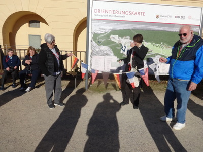
 The palace courtyard is bounded on the river side sheer cliffs down to the water. At the left is a different 3D relief map, this one showing the confluence of the two rivers, the town in the acute angle between the two, and the fortress up on the high ground at the left side. Behind it, you can see part of the railing along the top of the cliff, along with some of the inevitable padlocks and the shadows of others.
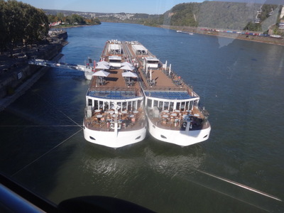
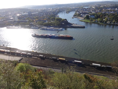
At the right is the view over that railing. A large container barge is passing on the Rhine. Behind it are the two Viking ships, and above them, you can see the sun shining off the cables of the cable-car line, which runs diagonally from the far shore up to the upper terminal a good ways to my right as I took the picture.
The sharp corner between the two rivers is called the "Deutsches Eck," the German Corner. The name Koblenz is a corruption of the Latin word for confluence. Note the very different colors of the Moselle, flowing in from the background, and the Rhine in the foreground.
The fortress is not yet a UNESCO site, but they're working on it. It is the venue for cultural activities, orchestras, youth hostels, and restaurants. At the end of the tour, our guide introduced himself, out of character. He is Viktor Lee, 21 years old, full-time actor and dubbing actor and some-time tour guide.
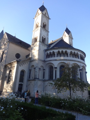
 Back down in the town, rather than walking straight back to the ship, we detoured inland a little ways to pass through a churchyard, sculture garden, and flower garden we'd toured in 2019. At the left here is St. Kastor, which played a major role in the division of Charlemagne empire among his three sons.
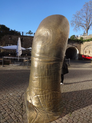
At the right is the small (2-m-tall) exemplar of Cesar's Thumb, which I admired last time. On the 2019 Koblenz page, you can see the other side of it, with the thumbnail.
We also passed the three panels from the Berlin Wall that stand in the garden; again, see the 2019 page.
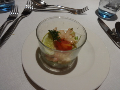
 For dinner I started with the Norwegian baby shrimp cocktail with apple, celery, and Marie Louise dressing (though the smoked sausage and pea soup sounded good). My main course was roasted veal sirloin with Parmesan crusted polenta.
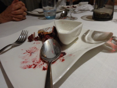
For dessert I chose the cherry strudel with yogurt ice cream over the "appelflappen," apple fritters. I'd had those before, and they weren't at all crisp, so the strudel sounded better.
Previous entry
List of Entries
Next entry